

Post Preview
Key Takeaways
- Reliable site information exposes constraints before they become construction problems.
- Surveys guide decisions on building placement, access, grading, utilities, drainage, and open space.
- Early environmental and stormwater review can reduce surprises during redesign and permitting.
- Digital mapping tools improve analysis, but field verification and professional judgment remain essential.
- Strong coordination connects survey work, design, approvals, and construction from the beginning.
Land development decisions are strongest when they begin with a clear understanding of the property as it exists today. Accurate measurements, current mapping, and early review of site conditions help owners and project teams identify practical options before committing to a layout, budget, or construction schedule.
Whether a project involves a new home, a commercial building, a roadway improvement, or a community space, professional land development services can help translate real-world site conditions into practical planning decisions. The goal is not simply to create a plan that fits on paper. It is to create one that respects boundaries, terrain, drainage, access, utilities, and nearby properties.
Why Site Data Matters Before Design Begins
Site data may include property lines, easements, elevations, slopes, drainage paths, visible utilities, trees, pavement, structures, and neighboring improvements. When this information is incomplete or outdated, early concepts can rely on assumptions that prove expensive to correct later.
For example, a modest elevation difference can affect driveway slopes, accessible routes, building entrances, drainage patterns, retaining-wall needs, and the amount of earthwork required. Reviewing dependable field information first allows a team to compare alternatives while changes are still easier to make. Publicly available topographic maps can provide useful regional context, but they do not replace a project-specific survey.
The Main Types of Site Information
Boundary and Property Information
Boundary work establishes the legal and physical framework for planning. It can identify property lines, recorded easements, rights-of-way, access locations, encroachments, and neighboring features that may affect development. Confirming these items early helps prevent a proposed driveway, parking area, building, or utility route from conflicting with a restriction overlooked during concept planning.
Topographic Information
Topographic information describes the shape of the land. Elevations, slopes, high points, low areas, and natural drainage routes all influence how a site can function. A layout that works with existing terrain may reduce unnecessary grading and create more practical transitions between roads, parking, buildings, and landscaped areas.
Existing Features and Utilities
Existing roads, sidewalks, walls, buildings, pavement, storm drains, utility corridors, tree stands, streams, and wetlands should be mapped and reviewed together. A feature that appears minor in isolation may significantly affect the available area for construction, access, stormwater facilities, or required buffers.
How Surveys Shape a Better Site Layout
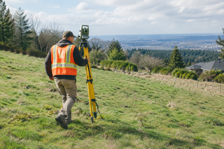
A current survey provides designers with a reliable basis for evaluating options rather than forcing the land into an inefficient concept. It supports a logical sequence of decisions:
- Confirm property limits and recorded constraints.
- Map physical features, improvements, and visible utility evidence.
- Review slopes, elevations, and drainage patterns.
- Identify practical constraints and potential opportunities.
- Compare building, parking, access, and open-space arrangements.
- Use the selected concept to guide detailed engineering and permitting.
Survey information can affect where a building is located, how vehicles enter and exit, where sidewalks connect, and whether utilities can be extended efficiently. It also helps construction teams work from plans that better reflect conditions they will encounter in the field.
Stormwater Planning Has a Larger Role
New roofs, pavement, and compacted areas can change how rainfall moves across a site. Stormwater planning considers where runoff flows before development, where it will flow afterward, and what measures are needed to manage water responsibly. Depending on the site and local requirements, solutions may include swales, detention systems, infiltration areas, permeable surfaces, rain gardens, and protected drainage paths.
Requirements differ by jurisdiction, watershed, and project scope, so early coordination matters. The U.S. Environmental Protection Agency explains that construction stormwater controls are intended to limit the discharge of pollutants, such as sediment, from active sites. Reviewing drainage early also helps avoid directing runoff toward neighboring properties or creating maintenance issues not anticipated in the concept plan.
Environmental Checks Can Protect a Project and Its Neighbors
Early review of trees, streams, wetlands, soils, flood-prone areas, and erosion risks supports informed choices before site disturbance begins. These checks can help a team preserve sensitive features where feasible, plan tree protection and landscape areas, identify potential agency reviews, and shape erosion-control measures around actual conditions.
Small projects are not automatically simple projects. A limited site with steep grades, poor drainage, constrained access, or sensitive environmental features may require particularly careful planning. Identifying those conditions before construction reduces the likelihood of changing the design after work is underway.
Where Digital Tools and Artificial Intelligence Fit
Drones, 3D scanning, geographic information systems, cloud-based mapping, and digital terrain models can quickly organize large amounts of information. These tools can help teams visualize slopes, compare layout alternatives, estimate earthwork, and identify areas that deserve closer review.
Artificial intelligence may also assist with pattern recognition and preliminary comparisons, such as highlighting terrain changes or organizing large site datasets. Still, technology is only as dependable as the information it is supplied with. Field verification, professional interpretation, and sound engineering judgment remain necessary when decisions affect safety, permitting, construction cost, and long-term performance.
Common Mistakes That Create Delays
- Starting design before confirming boundaries and easements.
- Relying on old plans without checking current conditions.
- Ignoring drainage patterns beyond the property line.
- Researching utility needs is too late in the process.
- Assuming a site is easy to grade because it appears flat.
- Overlooking trees, wetlands, flood concerns, or unstable soils.
- Failing to coordinate survey, environmental, engineering, and construction input.
A Practical Pre-Design Checklist
- Gather deeds, plats, available permits, maps, and prior plans.
- Complete a current field survey appropriate to the project.
- Confirm property limits, access rights, and known easements.
- Map existing improvements, utilities, terrain, and drainage features.
- Review environmental, flood-related, and soil-related constraints.
- Identify applicable zoning, access, and stormwater requirements.
- Compare more than one site-layout option when practical.
- Test the preferred concept for grading, access, drainage, and utilities.
- Update plans when new field information becomes available.
How Better Coordination Improves the Final Result
The most effective projects treat survey, design, permitting, and construction as connected steps. Field teams provide current information, designers develop practical solutions, environmental specialists identify sensitive features, and builders gain plans that better match the site. Better site data does not guarantee a simple project, but it gives every decision a more reliable foundation.
